Wadi Falij el-Hunud Road
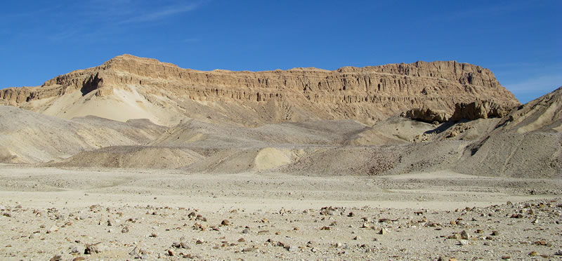
During our survey of the environs of the settlement site (M08-09/S1), we also recorded a desert track that leads north-east, entering the eastern desert through the Wadi Falij el-Hunud (Figure 1). Ceramic remains along the road are sparse, but indicate activity during the pharaonic period.
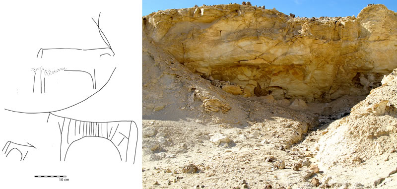
In an area about 12 km east of the settlement site, the road passes between two cliffs, which focuses the track into a narrower area and brings the traveler in contact with flat limestone surfaces ideal for carving; two rock inscriptions were discovered in this area (Figure 2). One large, left-facing bovid with internal decoration appears in conjunction with a much smaller bovid facing to the right and a horned quadraped above; the exaggeratedly long horns of the main cow are typical of Early and Middle Nubian bovid iconography.1

One of the most extensive collections of ceramic material along the road occurred two kilometers beyond the rock inscriptions, near a natural rock overhang about thirty meters from the ancient track (Figure 3). A low, dry-stone wall was constructed to create a small shelter beneath the overhang, and associated ceramic material included a significant amount of Marl A1 body sherds, including one from a tall, conical vessel, and a variety of “rough ware”/Nile C sherds from thick-walled (>3 cm) vessels. The track continues east past this Predynastic stopping point, and we hope to explore the full extent of this road in future seasons.

Most likely, this new eastern desert road is a branch of the north-south route that connects El Kab and Medamud.2 The settlement at the end of the track (M08-09/S1), potentially ancient Hefat, would be well placed to access the extensive network of eastern desert roads, granting the town economic and strategic advantages; due to the sheer cliff faces and lack of deep wadis in the gebel north of M08-09/S1, no access into the eastern desert is possible at any point between Mo‘alla and M08-09/S1, further increasing the importance of the eastern desert road and its Nilotic terminus. Although not prominent in the textual record, the connections between the Third Nome and the Eastern Desert via tracks such as the Wadi Falij el-Hunud Road will be significant in the interpretation of archaeological remains in the area and for writing a history of the nome.3
Notes
- 1. See inter alia A. Nordström, Neolithic and A-Group Sites (Stockholm 1972), pl. 26; P. Hellström, H. Langballe, and O. Myers, The Rock Drawings 2: Plates (Stockholm 1970), pl. 60, fig. 4; P. Cervicek, Felsbilder des Nord-Etbai, Oberägyptens und Unternubiens (Wiesbaden, 1974), Abb. 35, 139, 140, 146, 350, 351, 410, 412, 414, 417, 418.
- 2. On this route, see J. C. Darnell, “Hathor Returns to Medamud,” SAK 22 (1995): 93-94.
- 3. Compare the examination of the Eastern Desert connections of the “Hare nome” in S. Aufrère, “The Deserts and the Fifteenth and Sixteenth Upper Egyptian Nomes during the Middle Kingdom,” in R. Friedman, ed., Egypt and Nubia: Gifts of the Desert (London, 2002), pp. 207-214.
