Terrestrial Laser Scanning
YMAP-South has employed terrestrial laser scanning as a method of digital recording and as a basis for conservation strategies.
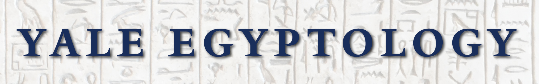
The technique of terrestrial laser-scanning (TLS) is a relatively recent addition to the archaeological toolkit in Egypt, achieving spectacular results at the nearby Red Monastery church in 2015.[1] It provides a millimeter-accurate record of the condition of the scanned features that, when combined with photographic and geo-referencing data, can be used to produce a digital three-dimensional (3D) reality-based model. The model may be manipulated to produce outputs in a variety of media that cannot be achieved through standard archaeological methods such as drawing and photography (fig. 1). The Yale Monastic Archaeology Project South (YMAP-South) has found both the 3D model and its outputs particularly useful in planning conservation interventions at the Church of St. Shenoute. It has also facilitated visualization of the church in ways that are impossible on the ground and will potentially be used to develop ideas about the original appearance of this and other buildings within the ancient monastery and how such structures changed over time (i.e. 4D reconstruction, with time constituting the fourth dimension).[2]
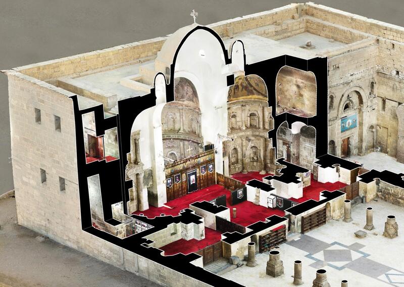
Figure 1. Cutaway perspective of the sanctuary of the Church of St. Shenoute.
Two TLS surveys were conducted at the White Monastery by Pietro Gasparri and his team from CPT Studio in Rome.[3] A test-scan of the severely deformed north wall of the Church of St. Shenoute (fig. 2) was completed in 2015 by Gasparri, assisted by Giovanni Tamburro (onsite and data processing), Pietro Pugini (data processing), and Emiliano Quaresima (data processing). This work aimed to document the wall’s condition and to assess both the feasibility and potential challenges of the wider application of this technique at the White Monastery. In spring 2019, a full TLS survey of both the church and the archaeological areas of the White Monastery was rolled-out by Gasparri, assisted by Tamburro and Massimo Carderi (fig. 3). Logistical support was provided Nicholas Warner, Gillian Pyke, and Sharif Munir Adly, in close collaboration with the monastic leadership and local archaeologists from the Ministry of Antiquities. In addition to 2D outputs, the 2019 survey resulted in a set of high-definition 3D models and a nine-minute video that shows how these models can be used to document the site.
Figure 2. The Church of St. Shenoute as it appeared in 2019, looking south east, showing the deformation of the north wall (left).
Figure 3. Pietro Gasparri, Giovanni Tamburro, and Massimo Carderi working in the southern archaeological area in 2019.
The topography of both the church and archaeological areas of the White Monastery presented a number of challenges. Inside the church, the sanctuary’s central dome stands some 16 m above the floor. All levels of its lobes include complex niches, and the east and south semi-domes contain detailed painted images (fig. 4). Some spaces in the upper part of the church, particularly at its east and west ends, are small, unlit, and difficult to access. (fig. 5). The high walls of the now-unroofed areas produce shadows throughout most of the day and access to the church’s well was hampered by ironwork and various trip hazards. Most parts of the church are populated with furniture and other items that had to be carefully removed and then returned to their positions. The room located at the eastern end of the church’s south hall has been converted to a shop: there, the abundance of stock on display and in storage was such that it could not be disturbed. Such contextual considerations illustrate the need for diverse modes of engagement with cultural heritage concerns when it comes to the Coptic community’s current use of the structure.
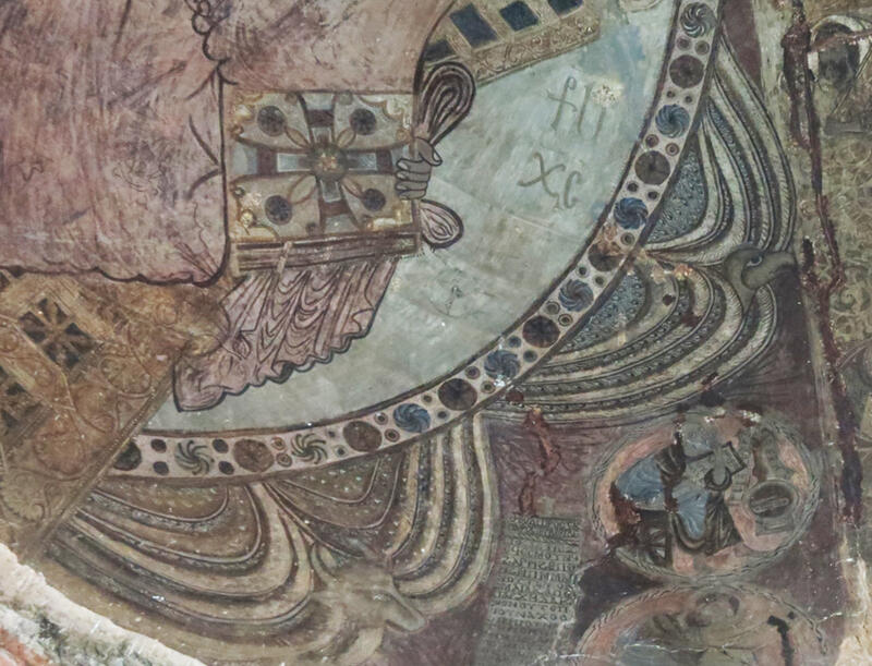
Figure 4. Detail of the lower south side of the image of Christ in Majesty in the eastern semi-dome of the Church of St. Shenoute.
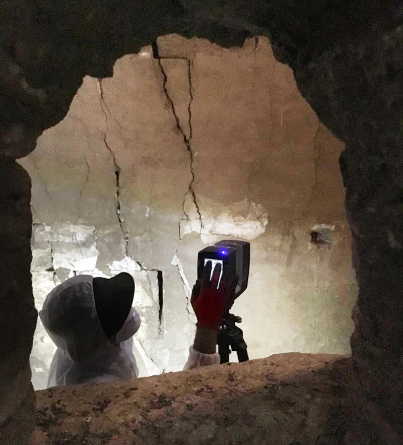
Figure 5. Giovanni Tamburro scanning inside one of the unlit rooms above the church sanctuary.
The archaeological remains at the White Monastery cover a huge area, some 3.5 hectares, and careful preparation was required to ensure that all architectural elements were clearly visible. The process of thorough cleaning involved the removal of fallen archaeological materials no longer in their original location, as well as modern refuse and windblown sand. The strong, gusty winds of the winter-summer transition ensured that both the refuse and sand would make frequent, unwelcome returns, requiring the swift refreshing of each area immediately prior to scanning. Conservation measures were removed and later reinstated (fig. 6), with the reburial of selected areas with clean sand for their future protection. In addition to highly decorated and constricted spaces, such as the Funerary Chapel and its subterranean tomb, and the 12m deep well, topographic challenges here included fragile constructions and surfaces, abundant trip hazards, and large areas of sand where the architecture no longer survives.
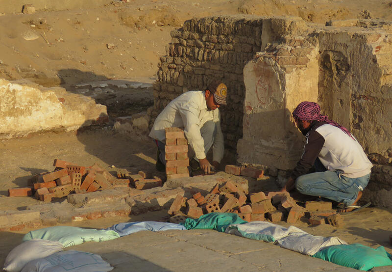
Figure 6. Yasser Aid and Malak Hanna reinstating a protective wall after the scanning survey in the Funerary Chapel in 2019.
The scheduling of the work for April also meant that the working conditions in the exposed archaeological areas were not ideal. The gusty winds presaged a temperature rise from the relative comfort of about 25°C (77°F) to a blistering 45°C (113°F). With no shade available, working hours were dictated by light rather than heat. Despite shading with a parasol, the scanner often reached its maximum operating temperature, halting work until it cooled (fig. 7).
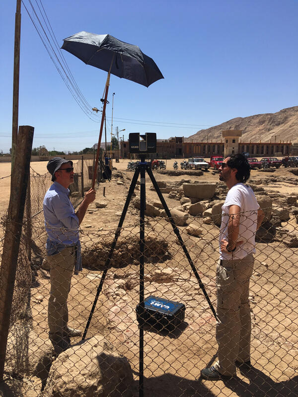
Figure 7. Parasol shading for the laser scanner, operated by Pietro Gasparri and Massimo Carderi during work in the southern archaeological area in 2019.
Pietro Gasparri designed a flexible strategy of data acquisition driven by the types and complexity of surfaces, as well as the distance and angle of survey, to facilitate the production of multi-scale and multi-resolution 2D and 3D outputs. Four techniques were employed: terrestrial laser scanning, photography, photogrammetry, and geo-spatial surveying.
Recording with a phase-shift terrestrial laser scanner (FARO Focus S70) produced an accurate geometric record of shape and texture as a set of data points (3D point cloud) resulting from the laser beam measurements (fig. 8). Scan resolution was a function of the distance from the surfaces and the detail of the surfaces. Additional scans were made from a 5m scaffold to ensure full coverage at sufficient resolution inside the church sanctuary (fig. 9).
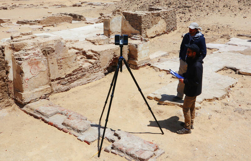
Figure 8. Giovanni Tamburro and Massimo Carderi scanning in the Funerary Chapel in 2019.
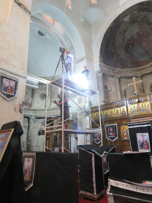
Figure 9. Pietro Gasparri scanning from the top of the 5m scaffold inside the church sanctuary in 2019. The black-draped stands are furnishings used during the celebration of Easter, moved to facilitate the work.
Two photographic techniques were employed, both using a high-resolution digital camera (Eos 5D Mark IV Canon). In the first, photographs were taken from the position of the laser scanner to improve the color quality of the laser scans. These images were correctly positioned by means of 14,000 points of correspondence detected on the photos and scans to create 3D projectors. The 3D projectors are placed in the 3D space in a position similar to those from which the photographs were taken. They work like real-world movie or slide projectors, but the image is projected onto the surface of the model’s geometry rather than a flat white screen. This tool allows the recoloring of scans and other 3D objects by using specific photographs taken on site and by projecting the texture directly onto the 3D geometry of an integrated model (fig. 10).
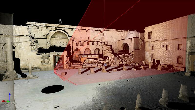
Figure 10. Screenshot showing position and projection direction of a 3D projector in the model of the Church of St. Shenoute.
The upper parts of the internal and external facades of the church were surveyed only by TLS and photographs from the points of scans. The lower parts of the church walls and the more detailed surfaces—such as paintings, reused pharaonic blocks (fig. 11), and niches—were integrated through a high-resolution (0.25–1.00 mm/pixel), 3D photogrammetric survey. This doubled the data, with one dataset consisting of the 3D polygonal structures (meshes) from photogrammetry and the other consisting of the point cloud from the TLS scans. As a result, we were able to produce high-definition 3D models and 2D outputs.
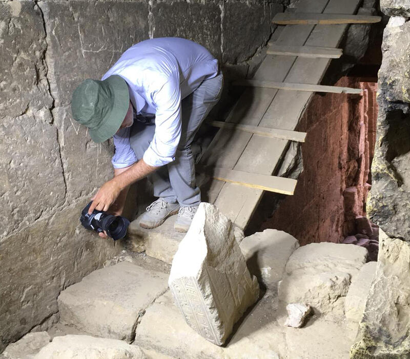
Figure 11. Pietro Gasparri photographing a pharaonic block in the western staircase of the church of St. Shenoute in 2019.
Multi-level photography, taken from the ground using an 8m telescopic monopod and operating the camera via smartphone with WiFi connectivity (fig. 12), was completed throughout the archaeological area, with the goal of producing a set of high-definition, ortho-photographic plans. An unmanned aerial vehicle (UAV or ‘drone’) was not employed because this technology is not permitted in Egypt.[4] High resolution photography was used for the visual program within the Funerary Chapel, especially the tomb, which had been stabilized and cleaned by a team of conservators led by Luigi de Cesaris, Alberto Sucato, and Emiliano Ricchi under the direction of Elizabeth Bolman.[5]
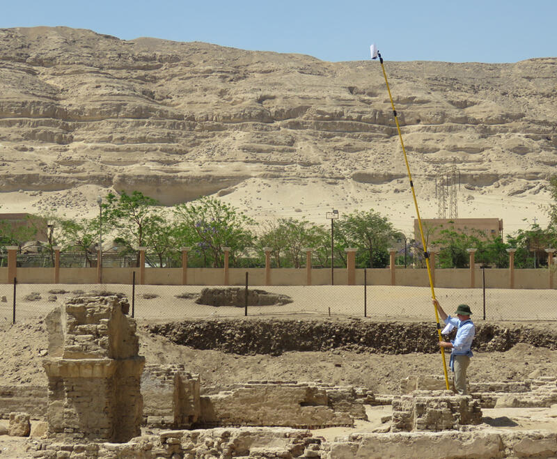
Figure 12. Pietro Gasparri using the monopod for photogrammetry in the southern archaeological area in 2019.
Geospatial data (in the form of co-ordinates) were acquired with a Leica FlexLineTS02 plus Total Station. The co-ordinates helped to ensure the correct alignment of scans and photographs and established the absolute global position of the 3D model. A set of seven site benchmarks or permanent Ground Control Points (GCPs) and two architectural reference points had been established by Dawn McCormack and Darlene Brooks Hedstrom in 2005 and subsequently managed by Louise Blanke (2008–2012).[6] By 2019, all except one had all been removed or could no longer be sighted. The survey took advantage of this last benchmark, and established orientation through the internal GPS of the laser scanner. Temporary GCPs were also installed for the purposes of the TLS survey.
An initial raw alignment phase of processing on site monitored the progress of the work and ensured that all the survey data had been collected successfully (fig. 13). The data were checked on site using three laptops and saved in two further copies on 2TB external hard drives. Two laptops were mainly dedicated to the pre-alignment of scans (Asus Notebook Gaming GL503V; ACER Aspire 7 A715-71G-71Q5) and one to the first pre-processing of pictures and photogrammetric models (HP Pavilion 15t-au100). This phase facilitated discussion of potential outputs from the final model with other members of the YMAP-South team and also allowed the demonstration of preliminary versions of the 3D model to the monastic leadership and Egyptian colleagues.
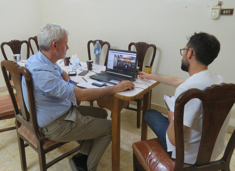
Figure 13. Pietro Gasparri and Giovanni Tamburro assessing the modeling of the iconostasis screen in the church sanctuary in 2019.
Once back at CPT Studio in Rome, Pietro Gasparri and his team spent three months creating the 3D model and producing a portfolio of outputs (figs. 14–15). The post-processing was managed in three phases of work under the supervision of Pietro Gasparri. The team was coordinated by Edoardo Dalla Palma. Three technicians (Edoardo Dalla Palma, Massimo Carderi, and Giovanni Tamburro) worked on the alignment of the scans, processing the photographs and producing the ortho-images and raw 2D outputs. At the same time, four technicians (Gaia Rossi, Valentina Scarinci, Laura Pennacchia, and Chiara Frigieri) were working on the production of the 3D projectors for the recoloring of the scans. The final production of the CAD (Computer-Aided Design) images was completed by the same four technicians, joined by Edoardo Dalla Palma and Massimo Carderi in the final stages of the work. A single program, Gexcel JR 3D Reconstructor, was used to create the model and outputs because it allows the management of a large quantity of data acquired both from photogrammetry (in this case about 12 thousand photographs) and laser scanning (about 16 billion points) in the same platform. Another advantage of this program is that its 3D projectors (a tool not typically found in similar software) are particularly flexible and accurate. The program is also especially good at producing high quality photo-realistic outputs in a variety of formats, as well as a range of various deliverables, including video. FARO SCENE was used for some of the scan alignment and Agisoft Metashape for some of the 3D photogrammetric models.
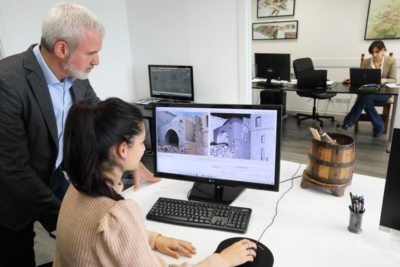
Figure 14. Pietro Gasparri and Gaia Rossi review the production of 3D projectors at CPT Studio in Rome.
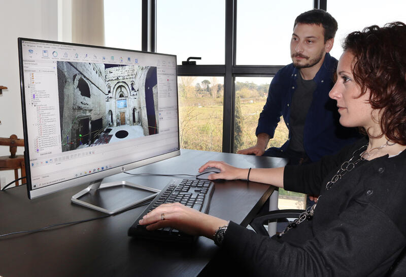
Figure 15. Laura Pennacchia and Edoardo Dalla Palma manipulate a recoloured scan at CPT Studio in Rome.
The finalized 3D model is a photo-realistic record of the site as it appeared in 2019, integrating the church into the wider built environment of the monastery. It allows production of a wide range of 2D and 3D outputs that are able to combine presentational styles (e.g. line drawings and photo-realistic images) and show otherwise impossible views (e.g. cross-sections and cutaways; see fig. 1) for reproduction on a variety of platforms. Several recent outputs complement and extend previous work at the White Monastery. These include plans, wall-elevations, and cross-sections of the Church of St. Shenoute (fig. 16), as well as surveys of the church’s niches (fig. 17) and reused pharaonic blocks (fig. 18).[7] The 3D model will also be employed in the ongoing investigation of the monastery’s built environment, especially in developing visualizations of its ancient appearance through 4D digital reconstructive modelling.
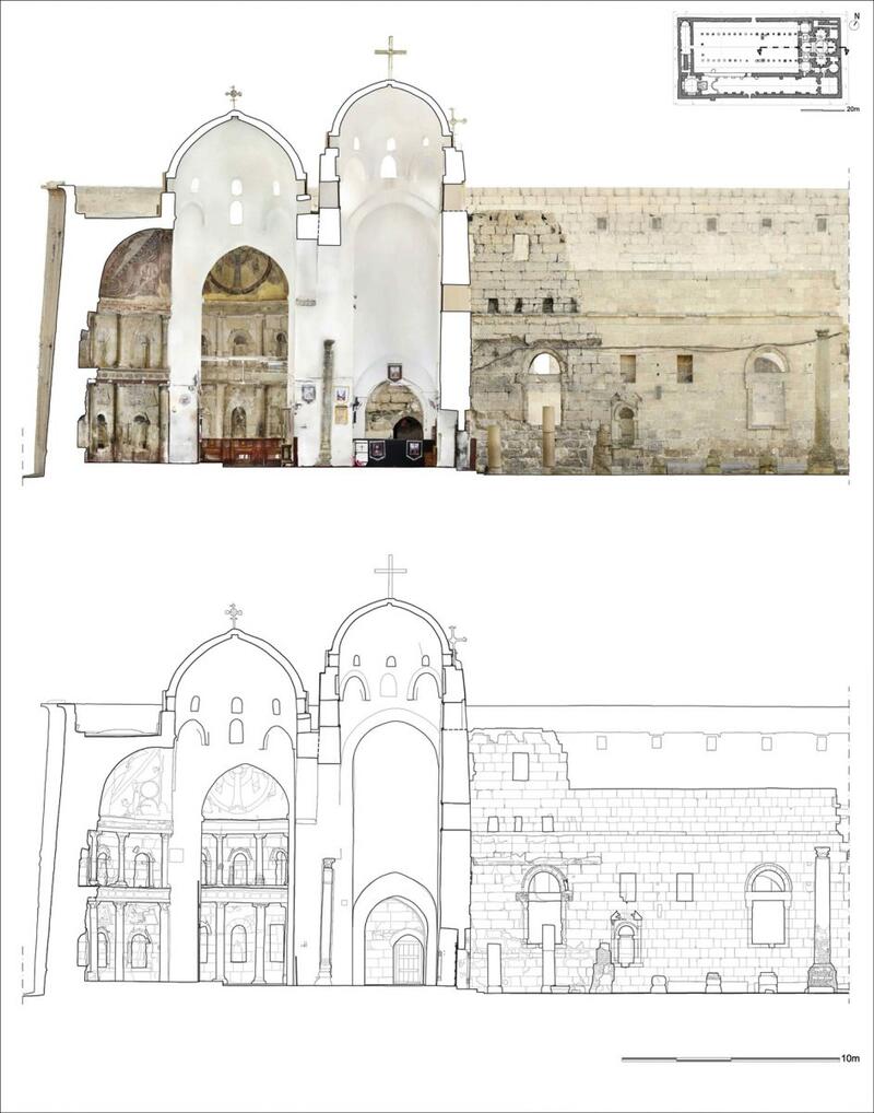
Figure 16. Photo-realistic (top) and line-drawing (bottom) cross-sections through the east half of the Church of St. Shenoute (sanctuary and part of the nave) produced from the 3D model.
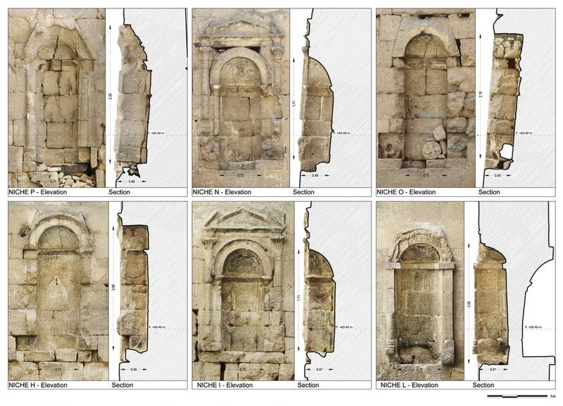 Figure 17. Digital records of niches in the narthex of the Church of St. Shenoute.
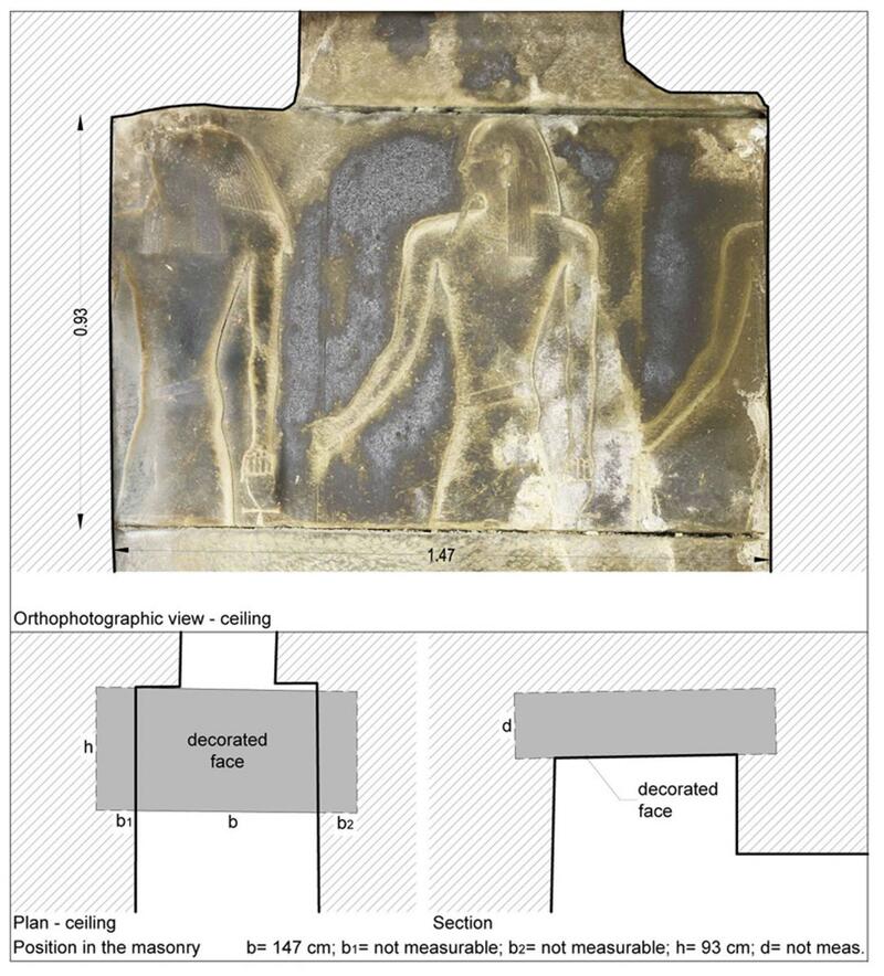
Figure 18. Example of the digital record of a pharaonic block used in the construction of the west staircase of the Church of St. Shenoute.
The 3D model is an important tool in YMAP-South’s ongoing cultural heritage management and conservation at the White Monastery. A short video made by Pietro Gasparri and his team and edited by Edoardo Dalla Palma highlights the White Monastery’s significance as a Christian monument, which was internationally recognised when the site was placed on the ‘2002 List of 100 Most Endangered Sites’ published by the World Monuments Watch (fig. 19).[8] The video provides an important introduction to the site and its cultural value, engaging with new audiences through this highly accessible online platform and underscoring the importance of protecting the White Monastery for future generations.
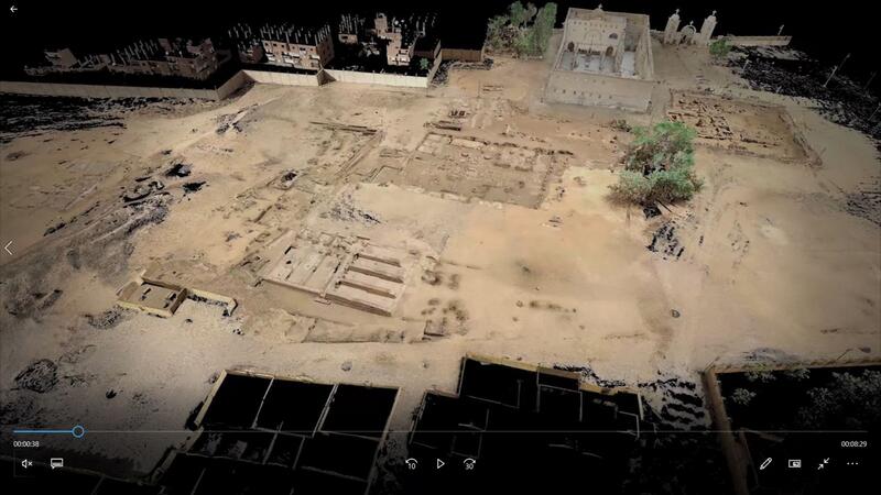
Figure 19. Screenshot of the video output from the TLS survey showing a view of the Church of St. Shenoute (top), western archaeological area (centre), Funerary Chapel (bottom left) and southern archaeological area (right). Click on the image to access the video.
As was seen in the 2015 test and 2019 survey, repeat scans provide an accurate record of changes to the site. These provide data that allow the monastic leadership and representatives from the Ministry of Antiquity to take some aspects of conservation stewardship into their own hands while continuing to liaise with YMAP-South to ensure the survival of this precious heritage. The two sets of scans focusing on the north wall of the church—the first made in 2015; the second in 2019—act as a condition report for the purpose of conservation monitoring.[9] This work has facilitated the investigation of concerns expressed by local stakeholders regarding the cracks and deformation visible in the structure of the wall (fig. 20).
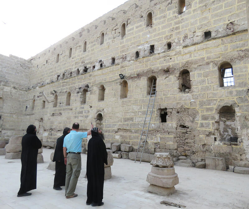
Figure 20. Architect Nicholas Warner discusses the condition of the north wall of the church with Fam al-Shenouti and Athanasius al-Shenouti from the White Monastery and Shenoute al-Bishay from the Red Monastery in 2019.
Change detection analysis (CDA) was used to determine whether there had been movement in the wall over this five-year period. When the church was constructed, this wall had been braced by the roof, gallery and columns. After the roof fell, it continued to be somewhat buttressed by houses built inside the nave. While some change in shape is already visible in a photograph published by Ugo Monneret de Villard in 1925, it was the final clearance of housing in 1985 that removed support from the wall’s inner face.[10] The CDA implemented by YMAP-South was able to map the recent movement of the wall. In 2015, it leaned inwards 70 cm out of plumb at its centre, but by 2019 it had moved a further 3.5 cm (fig. 21). In this way, 3D modelling data is proving invaluable for structural analysis and for strategic planning, as YMAP-South prepares to undertake the conservation measures necessary to stabilize the wall.
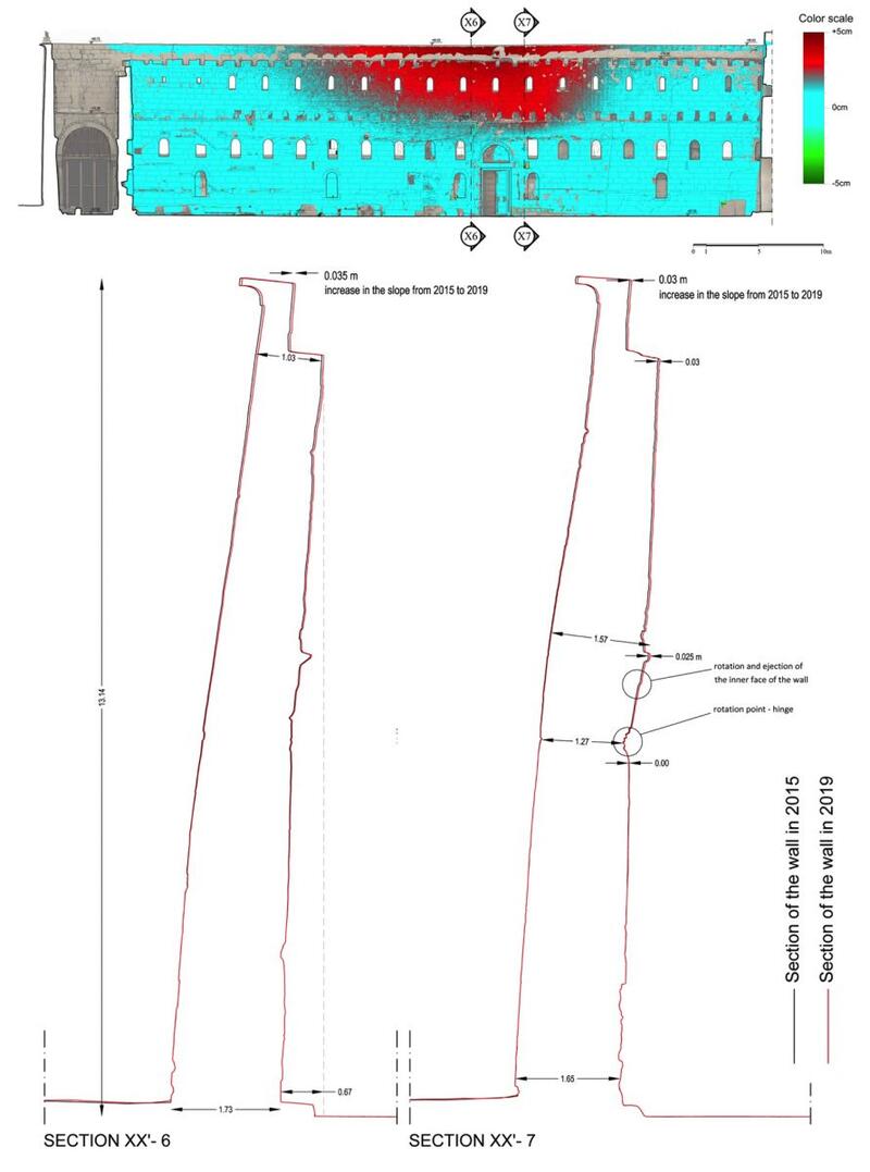
Figure 21. Change detection analysis showing movement of the north wall of the church (above), with sections of the wall recorded in 2015 and 2019 (below).
[1] N. Warner and E. Bolman, “Digital Heritage Preservation: 3D Laser Scanning the Red Monastery Church,” Bulletin of the American Research Center in Cairo 209 (2017), 11–16. For a video of the three-dimensional survey of the Red Monastery church, see https://www.youtube.com/watch?v=yX8x4jYzenI.
[2] S. J. Davis, P. Gasparri, G. Pyke, and N. Warner, “A Three-Dimensional Survey: Digital Preservation at the White Monastery in Sohag,” Scribe 7 (2021), 8–15. For an introduction to terrestrial laser-scanning (TLS) in archaeology, see N. Lercari, “Terrestrial Laser Scanning in the Age of Sensing,” in Digital Methods and Remote Sensing in Archaeology: Archaeology in the Age of Sensing, ed. M. Forte and S. Campana (Cham: Springer, 2016), 3–34, available at https://link.springer.com/content/pdf/10.1007%2F978-3-319-40658-9.pdf; D Hoffmeister, “3D Laser Scanning for Geoarchaeological Documentation,” in Digital Geoarchaeology: New Techniques for Interdisciplinary Human-Environmental Research, ed. C. Siart, M. Forbriger, and O. Bubenzer (Cham: Springer, 2018), 183–201, available at https://link.springer.com/content/pdf/10.1007%2F978-3-319-25316-9.pdf. For examples of TLS in the conservation and heritage management of archaeological sites, see: F. Remondino, “Heritage Recording and 3D Modelling with Photogrammetry and 3D Scanning,” Remote Sensing 3 (2011), 1104–1138; A. Guarnieri, N. Milan and A. Vettore, “Monitoring of Complex Structure for Structural Control Using Terrestrial Laser Scanning (Tls) and Photogrammetry,” International Journal of Architectural Heritage 7:1 (2013), 56–67. For examples of 4D reconstructions of archaeological subjects, see: P. Rodriguez-González, A. L. Muñoz-Nieto, S. del Pozo, L. J. Sanchez-Aparicio, D. Gonzalez-Aguilera, L. Micoli, S. Gonizzi Barsanti, G. Guidi, J. Mills, K. Fieber, and I. Haynes, “4D Reconstruction and Visualization of Cultural Heritage: Analyzing our Legacy Through Time,” The International Archives of Photogrammetry, Remote Sensing and Spatial Information Sciences. Volume XLII–2/W3, 2017, 3D Virtual Reconstruction and Visualization of Complex Architectures, 1–3 March 2017, Nafplio, Greece, published online, available at https://www.int-arch-photogramm-remote-sens-spatial-inf-sci.net/XLII-2-W3/; P. Rodriguez-González, A. G. Campo, Á. L. Muñoz-Nieto, L. J. Sanchez-Aparicio, and D. Gonzalez-Aguilera, “Diachronic Reconstruction and Visualization of Lost Cultural Heritage Sites,” ISPRS International Journal of Geoinformation 8 (2019), published online, available at http://www.mdpi.com/journal/ijgi.
[3] For the work of Pietro Gasparri and CPT Studio at other ancient sites, see: http://www.cptstudio.it/en/.
[4] The use of UAVs in an archaeological setting is quite common outside Egypt. For an introduction, see A. Pecci, “Digital Survey from Drone in Archaeology: Potentiality, Limits, Territorial Archaeological Context and Variables,” in IOP Conference Series: Materials Science and Engineering 949 (2020), 012075, published online, available at https://iopscience.iop.org/article/10.1088/1757-899X/949/1/012075/pdf; S. Campana, “Drones in Archaeology. State-of-the-art and Future Perspectives,” Archaeological Prospection 24 (2017), 275–296. For examples, see Y. Lin, T. Wang, M. Han, S. Liu, and Z. Huang, “Research on Cultural Landscape Supported by Digital Technology,” Journal of Physics: Conference Series 650 (2020), 032200, published online, available at https://iopscience.iop.org/article/10.1088/1742-6596/1650/3/032200/pdf; N. G. Smith, L. Passone, S. al-Said, M. al-Farhan, and T. E. Levy, “Drones in Archaeology: Integrated Data Capture, Processing, and Dissemination in the al-Ula Valley, Saudi Arabia,” Near Eastern Archaeology 77.3 (2014), 176–181.
[5] E. S. Bolman, L. Blanke, D. Brooks Hedstrom, M. Khalifa, C. Meurice, S. Mohammed, G. Pyke, and P. Sheehan, “Late Antique and Medieval Painted Decoration at the White Monastery (Dayr al-Abiad), Sohag,” Bulletin of the American Research Center in Egypt 192 (2007), 7; E. S. Bolman, L. de Cesaris, G. Pyke, E. Ricchi, and A. Sucato, “A Late Antique Funerary Chapel at the White Monastery (Dayr Anba Shenouda), Sohag,” Bulletin of the American Research Center in Egypt 195 (2009), 16–17, figs. 8–11; E. S. Bolman, S. J. Davis, L. de Cesaris, Fr. M. el-Anthony, G. Pyke, E. Ricchi, A. Sucato, and N. Warner, “The Tomb of St. Shenoute? More Results from the White Monastery (Dayr Anba Shenouda), Sohag,” Bulletin of the American Research Center in Egypt 3198 (2011), 35–37, figs. 6–7; E. S. Bolman, L. de Cesaris, A. Sucato, E. Ricchi, M. Kacicnik, S. M. M. Osman, A. Z. Aly, S. J. Davis, Fr. M. al-Anthony, G. Pyke, and A. Szymanska, “The Tomb of St. Shenoute at the White Monastery: Final Conservation and Documentation,” Bulletin of the American Research Center in Egypt 204 (2014), 21–23, figs. 1–4.
[6] D. L. Brooks Hedstrom, “An Archaeological Mission for the White Monastery,”Coptica 4 (2005), 5;L. Blanke, An Archaeology of Egyptian Monasticism, Yale Egyptological Publications 2, New Haven: Yale University Press, 2018, 61.
[7] For architectural drawings of the Church of St. Shenoute, see U. Monneret de Villard, Les couvents près de Sohâg (Deyr el-Abiaḍ et Deyr el-Aḥmar), 2 volumes (Milan: Tipografia Pontificia e Arcivescovile S. Giuseppe, 1925–1926), I, pls. 1–3, 19; II, pls. 124, 130, 132, 133, 136, 142, 197–199; P. Grossmann, Christliche Architektur in Ägypten (Handbuch der Orientalistik Section 1, Volume 62; Leiden: Brill, 2002), figs. 150–153. The 1962 set of architectural drawings made by the Darmstadt Technical Institute (now the Darmstadt Technical University) remains unpublished. For the niches, see P. Akermann, Le décor sculpté du Couvent Blanc: Niches et frises (Bibliothèque d’Études Coptes 14; Cairo: Institut français d’archéologie orientale, 1977). For the pharaonic blocks, see D. Klotz, “Triphis in the White Monastery: Reused Temple Blocks from Sohag,” Ancient Society 40 (2010), 197–213; D. Klotz, “A Naos of Nectanebo I from the White Monastery Church (Sohag),” Göttinger Miszellen 229 (2011), 37–52.
[8] P. Grossmann, D. Brooks Hedstrom, M. Abdal-Rassul, and E. S. Bolman, “The Excavation in the Monastery of Apa Shenute (Dayr Anba Shinuda) at Suhag,” Dumbarton Oaks Papers 58 (2004), 382.
[9] For a review of the use of TLS in this kind of work, see W. Mukupa, G. W. Roberts, C. M. Hancock, and K. Al-Manasir, “A Review of the Use of Terrestrial Laser Scanning Application for Change Detection and Devformation Monitoring of Structures,” Survey Review 49:353 (2017), 99–116.
[10] Monneret de Villard, Couvents, volume 1, pl. 9.